Geographic Information System for Mapping Polling Station Locations in Parungkuda District
##plugins.themes.academic_pro.article.sidebar##
Downloads
##plugins.themes.academic_pro.article.main##
Abstract
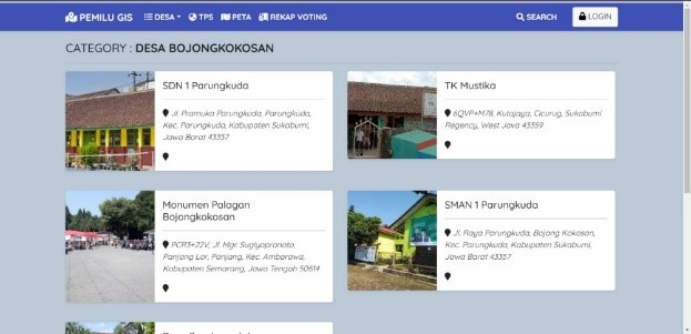
This study aims to develop a Geographic Information System (GIS) that maps the locations of Polling Stations (TPS) for general elections in Parungkuda District. Through literature review, field observations, and interviews with relevant stakeholders, geographical data such as TPS locations and district boundaries were collected and analyzed. In this research, a web-based information system was developed using Mapbox technology to display interactive mapping of the TPS. The outcome is a system that facilitates the public in finding TPS locations and obtaining information on the number of voters and presidential candidates in each TPS. This research has benefits in terms of mapping and accessing TPS-related information, and it is recommended for further development to be widely used in general elections within Parungkuda District. This GIS can improve the efficiency of the election process and provide ease of access for voters to find the appropriate TPS based on their residence.
##plugins.themes.academic_pro.article.details##

This work is licensed under a Creative Commons Attribution-NonCommercial 4.0 International License.
References
[2] I. M. A. W. Putra, "Rancang Bangun Sistem Informasi Geografis Pemetaan Tempat Kost di Kecamatan Kuta Selatan Menggunakan Framework Laravel," Jurnal Teknologi Informasi dan Komputer, vol. 5, 2019.
[3] L. Maulana, "Sistem Informasi Geografis Pemetaan Daerah Hama Wereng Pada Tanaman Padi Berbasis Android Dengan Google Maps Api, Di Kabupaten Banyumas," SAINTEKS, vol. 17, no. 2, 2020.
[4] M. Kirom, "SISTEM INFORMASI GEOGRAFIS PEMETAAN SUARA PEMILUKADA BERBASIS OPEN SOURCE DI KABUPATEN JOMBANG," Jurnal Ilmiah Edutic, vol. 1, no. 1, 2014.
[5] M. A. N. Islam, "Analisis dan Perancangan Geographic Information System pada Pelacakan Lokasi Kurir Secara Real Time Analysis and Design of Geographic Information System for Courier Location Real Time Tracking," Techno.COM, vol. 17, no. 2, pp. 186-196, 2018.
[6] M. Muslih, "Utilization of a Web-Based Geographic Information System for Land Mapping and Some Its Overview: A Case Study in Sukabumi District, Indonesia," International Journal of Design and Nature and Ecodynamics, vol. 17, no. 3, pp. 369-374, 2022.
[7] C. Yuliansyah, "Pemetaan Persebaran Fasilitas Umum Berbasis Sistem Informasi Geografis (Studi Kasus Di Propinsi Bengkulu)," Technologia, vol. 12, 2021.
[8] B. Mulyono, "Pemetaan Areal Potensi Konflik Izin Usaha Pemanfaatan Hasil Hutan Kayu Hutan Tanaman (Iuphhk-Ht) Berbasis Sistem Informasi Geografis (SIG) pada PT. RAPP Estate Mandau," Wahana Forestra: Jurnal Kehutanan, vol. 10, 2015.
[9] T. Nurhadiyan, "Sistem Informasi Geografis Pemetaan Lokasi ATM BNI Terdekat di Kota Serang Berbasis Android," Jurnal Sistem Informasi, vol. 4, 2017.
[10] Y. B. Mashita Enggar Kusuma, "Aplikasi Google Maps Api Dalam Pengembangan Sistem Informasi Geografis (Sig) Pariwisata Berbasis Web (Studi Kasus : Kabupaten Sidoarjo)," GEOID.
[11] A. Mulyani, "Sistem Informasi Geografis Pemetaan Tempat Oleh-Oleh di Kabupaten Garut Berbasis Android," Jurnal Algoritma, vol. 20, pp. 1-10, 2023.
[12] D. A. (. M. Mustakim (1), "Sistem Informasi Geografis Berbasis Web Untuk Pemetaan Komoditas Pertanian di Kabupaten XYZ," JISKa, vol. 1, no. 1, pp. 29-40, 2016.
[13] F. Masykur, "Implementasi Sistem Informasi Geografis Menggunakan Google Maps Api Dalam Pemetaan Asal Mahasiswa," Jurnal SIMETRIS, vol. 5, 2014.
[14] C. Surya, "Sistem Informasi Pemetaan Tempat Pemungutan Suara (Tps) Pada Panitia Pemilihan Kecamatan Mandau," Jurnal Jaringan Sistem Informasi Robotik (JSR), pp. 15-21, 2021.
[15] R. Putra, "Aplikasi SIG Untuk Penentuan Daerah Quick Count Pemilihan Kepala Daerah (Studi Kasus : Pemilihan Walikota Cirebon 2013, Jawa Barat)," Jurnal Geodesi Undip, 2013.
[16] Somantri, R. Turnadi, E. Gunawan and Y. Mulia, "Tsunami Evacuation System with Cluster Method And Dijkstra Algorithm Based Mobile Application In Palabuhanratu, West Java, Indonesia," IEEE Xplore, 2020.