Akselerasi Validasi Spasial melalui Plotting Data Digital PTSL di Loket Yuridis Kantor Pertanahan
##plugins.themes.academic_pro.article.sidebar##
Downloads
##plugins.themes.academic_pro.article.main##
Abstract
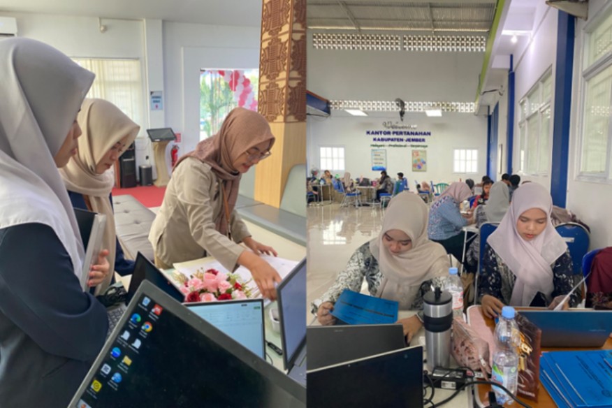
Pendaftaran Tanah Sistematis Lengkap (PTSL) tak sekadar menghasilkan dokumen, melainkan membentuk basis data pertanahan yang menuntut ketepatan serta keterhubungan informasi yuridis dan spasial. Masalah timbul saat data digital dalam jumlah besar memerlukan penataan ulang akibat ketidaksesuaian informasi.Kegiatan pengabdian ini bertujuan mendukung percepatan validasi spasial melalui plotting data digital PTSL di Loket Yuridis Kantor Pertanahan Kabupaten Jember. Metode dilakukan secara partisipatif, meliputi identifikasi awal, pengelompokan, pemeriksaan yuridis, pencocokan spasial, plotting, hingga penandaan data yang membutuhkan verifikasi lanjutan.Dari 1.248 bidang tanah, awal pendampingan mencatat 468 bidang (37,5%) terplot. Angka tersebut meningkat signifikan menjadi 1.086 bidang (87,0%) setelah pendampingan. Waktu pemrosesan rata-rata pun memangkas durasi dari 11,8 menit menjadi 6,9 menit per bidang Selain efisiensi, proses validasi menemukan 74 bidang bermasalah akibat tumpang tindih, pergeseran posisi, maupun ketidaksesuaian atribut. Hasil ini membuktikan bahwa plotting berfungsi efektif sebagai mekanisme pengendalian kualitas data untuk mendukung integrasi informasi dan kesiapan layanan pertanahan berbasis elektronik
##plugins.themes.academic_pro.article.details##

This work is licensed under a Creative Commons Attribution-NonCommercial 4.0 International License.
JURPIKAT (Jurnal Pengabdian Kepada Masyarakat) accepts manuscripts that have not been published elsewhere and are not under consideration for publication by other print or electronic media. Authors retain copyright and grant the journal right of first publication with the work simultaneously licensed under a Creative Commons BY-NC License that allows others to share the work with an acknowledgment of the work's authorship and initial publication in this journal.
Authors are able to enter into separate, additional contractual arrangements for the non-exclusive distribution of the journal's published version of the work (eg, post it to an institutional repository, in a journal or publish it in a book), with an acknowledgment of its initial publication in this journal.
License to Publish
The non-commercial use of the article will be governed by the Attribution-NonCommercial 4.0 International (CC BY-NC 4.0). The author hereby grants JURPIKAT (Jurnal Pengabdian Kepada Masyarakat) an exclusive publishing and distribution license in the manuscript include tables, illustrations or other material submitted for publication as part of the manuscript (the “Articleâ€) in print, electronic and all other media (whether now known or later developed), in any form, in all languages, throughout the world, for the full term of copyright, and the right to license others to do the same, effective when the article is accepted for publication. This license includes the right to enforce the rights granted hereunder against third parties.
References
Fetai, B., Tekavec, J., Fras, M., & Lisec, A. (2022). Inconsistencies in Cadastral Boundary Data—Digitisation and Maintenance. Land. https://doi.org/10.3390/land11122318
Fuad, F., Tardjono, H., Machmud, A., Rohayah, N., & Maghucu, P. (2023). Ownership of Land: Legal Philosophy and Culture Analysis of Land Property Rights. Jurnal Media Hukum. https://doi.org/10.18196/jmh.v30i2.18264
Gusmartin, P. H., Abdulharis, R., & Hernandi, A. (2025). The Development of a Procedure Model for Improving Land Data Quality (Case Study at the Land Office of Tulang Bawang Regency). Journal of Science and Applicative Technology. https://doi.org/10.35472/jsat.v8i2.1948
Hutagalung, S., Noor, M., & Jatmikowati, S. (2022). Land Certification Policy through Complete Systematic Land Registration (PTSL) in Malang Regencyof Indonesia(Study on Policy Implementation of the Minister of Agrarian Affairs and Spatial Planning/National Land Agency). International Journal of Research in Social Science and Humanities. https://doi.org/10.47505/ijrss.2022.v3.8.9
Iriantoro, A. (2025). Legal Certainty in the Implementation of the Transfer from Analog Certificate Media to Electronic Certificate. PENA LAW: International Journal of Law. https://doi.org/10.56107/penalaw.v3i2.244
Khudoyberdiyev, F. S. (2025). Investment Project Siting And Valuation Based On Land Cadastre. The American Journal of Management and Economics Innovations. https://doi.org/10.37547/tajmei/volume07issue12-05
Kusmiarto, K., Wahyono, E., Syaifullah, A., Wahyuni, W., Sitorus, O., Desmawan, H., Putra, B., Pratidina, N. P. A., & Wulandari, I. (2025). Digital Transformation of Land Services in Indonesia: A Case Study of Bogor, Sleman, and Buleleng. Marcapada: Jurnal Kebijakan Pertanahan. https://doi.org/10.31292/mj.v5i1.190
Martono, D., Aditya, T., Subaryono, S., & Nugroho, P. (2022). Cadastre Typology as a Baseline for Incremental Improvement of Spatial Cadastre in Jakarta: Towards a Complete Cadastre. Land. https://doi.org/10.3390/land11101732
Permadi, F. B., Widjajanti, N., Singagerda, F. A., & Riswanto, T. (2025). Spatial Quality Study of Land Parcels Resulting from Integrated Physical Data Collection in Samarinda City, Indonesia. Engineering Headway, 27, 569 - 585. https://doi.org/10.4028/p-xuj8xf
Prihatmaka, W., H., & Y. (2025). Issuance of Land Title Certificates as Legal Certainty Guarantee for Land Title Holders. JILPR Journal Indonesia Law and Policy Review. https://doi.org/10.56371/jirpl.v7i1.471
Savira, J., & Djajaputra, G. (2024). The Role of the Ministry of Agrarian Affairs and Spatial Planning/National Land Agency (ATR/BPN) as a Government Institution Facilitating the Electronic Land Certificate Policy. Journal of Law, Politic and Humanities. https://doi.org/10.38035/jlph.v4i4.418
Suwardhi, D., Ihsan, M., Widyastuti, R., Hasna, A., Mukminin, U., Akbar, B., Pasaribu, S. K., Satwika, P., Nurmaulia, S., & Hernandi, A. (2025). An Automated Framework for Cadastral Parcel Adjustment Using UAV Orthophotos, SAM, and ICP. The International Archives of the Photogrammetry, Remote Sensing and Spatial Information Sciences. https://doi.org/10.5194/isprs-archives-xlviii-2-w11-2025-277-2025
Suryani, R. (2023). Land in PMNA KA. BPN 21 of 2020 Concerning Handling of Settlement of Land Cases in Land Registration. Formosa Journal of Sustainable Research. https://doi.org/10.55927/fjsr.v2i3.3626
Taranova, O. (2022). Legal Status of Information in The Register of Real Rights to Immovable Property. European Political and Law Discourse. https://doi.org/10.46340/eppd.2022.9.2.4
Taufiq, F. N., Masykur, M., & Supriyadi, S. (2023). Challenges Arising from Article 22(2) of Ministerial Regulation ATR/BPN No. 6/2018 on Complete Systematic Land Registration (PTSL) Pertaining to Insufficient or Missing Evidence of Community Land Ownership. Unnes Law Journal. https://doi.org/10.15294/ulj.v9i2.75274
Tirumala, R., & Tiwari, P. (2022). Importance of Land in SDG Policy Instruments: A Study of ASEAN Developing Countries. Land. https://doi.org/10.3390/land11020218
Wulansari, H., Widiyantoro, S., & Widodo, S. (2024). Problematika dan Upaya Penyelesaian Desa Lengkap di Kabupaten Klaten. Tunas Agraria. https://doi.org/10.31292/jta.v7i1.278
Yuniawan, E. B., & Sulistyaningrum, E. (2025). Assessing the impact of the Complete Systematic Land Registration (PTSL) programme on land values in Indonesia: evidence from Rejang Lebong, Bengkulu Province. Journal of Property Research, 42, 356 - 379. https://doi.org/10.1080/09599916.2025.2495754
Budisusanto, Y. (2026). Design and Implementation of Land Information System Using Spatial Database. International Journal of Geoinformatics. https://doi.org/10.52939/ijg.v22i5.4983